Landmine Monitor maps and tables are provided in PDF format. PDF files are suitable for printing. Click here to read our copyright policy.
Global Maps
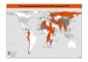 |
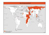
Mine and ERW Casualties in 2007
JPG | PDF |
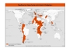 |
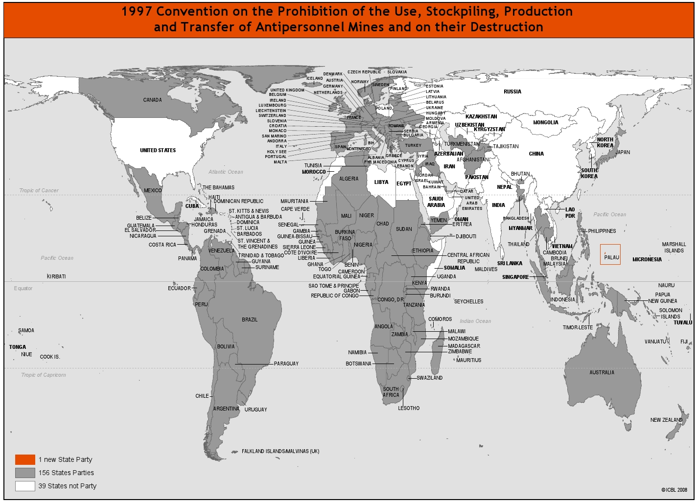
Global Contamination from Mines and ERW
JPG | PDF
|
 |
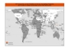
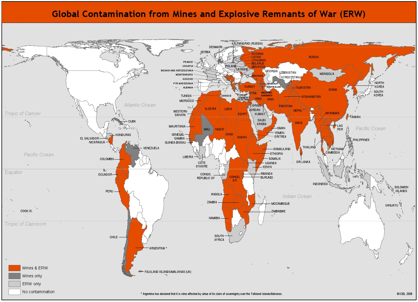
Deadlines for States Parties with
Article 5 Obligations
JPG | PDF
|
|
 |
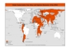
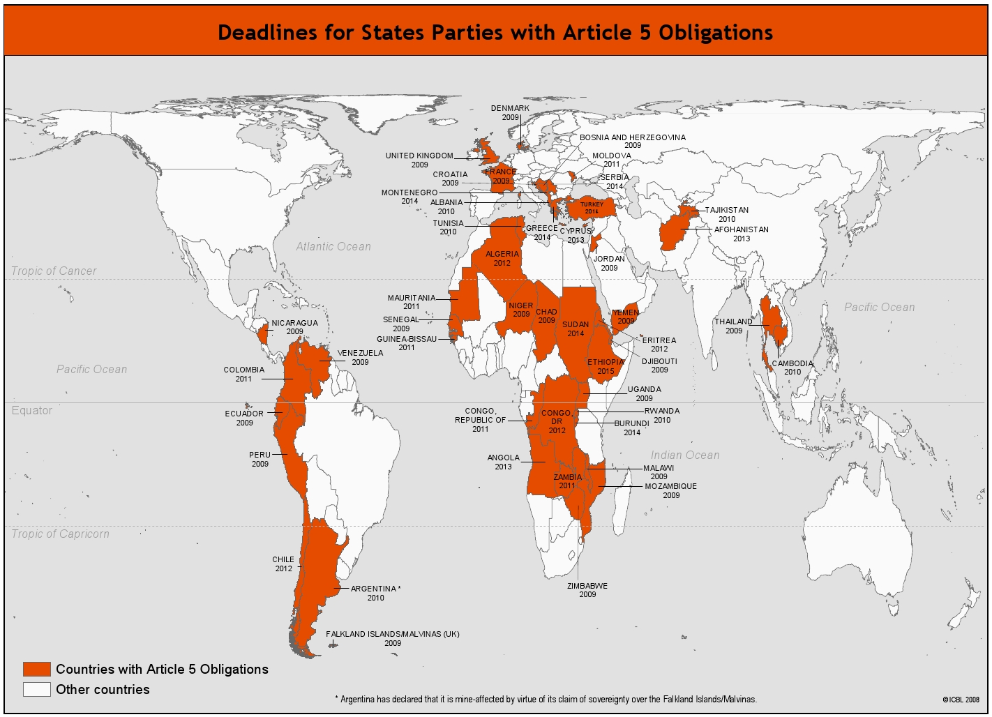
Mine Ban Treaty Status
JPG | PDF
|
 |
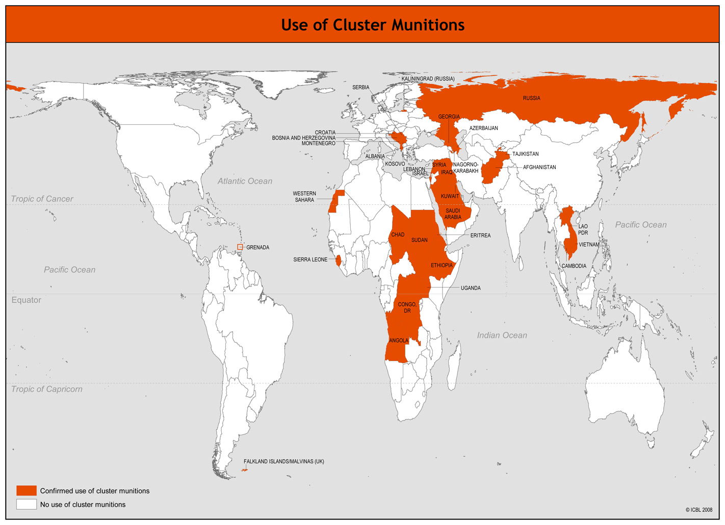
Use of Cluster Munitions
JPG | PDF
|
|
Contamination Maps
| Afghanistan |
-Areas contaminated by mines and UXOs in Afghanistan, MACA, March 2008.
-Regionalization of demining operations, MACA, 2008.
|
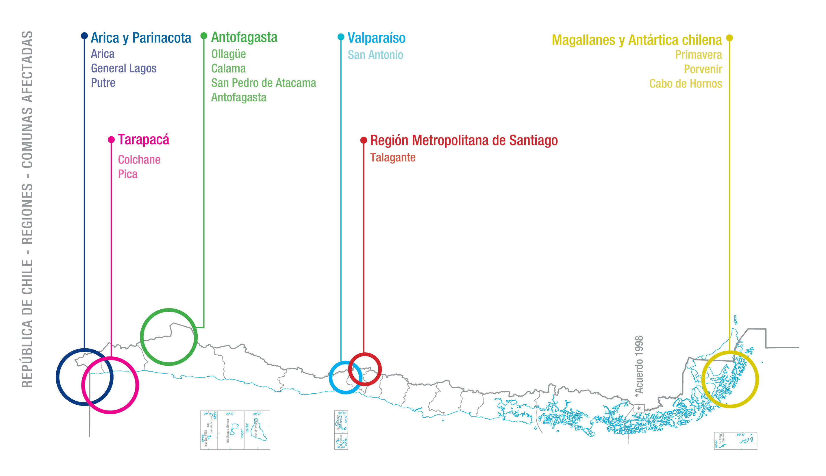
| Chile |
-Mine-Affected Areas in Chile, CNAD, February 2008. |
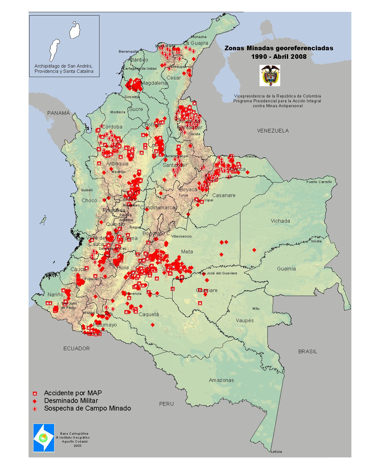
| Colombia |
-Mined Areas, PPAICMA, April 2008.
|
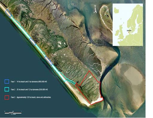
| Denmark |
-Mine affected areas, Danish Coastal Authority, 2008. |
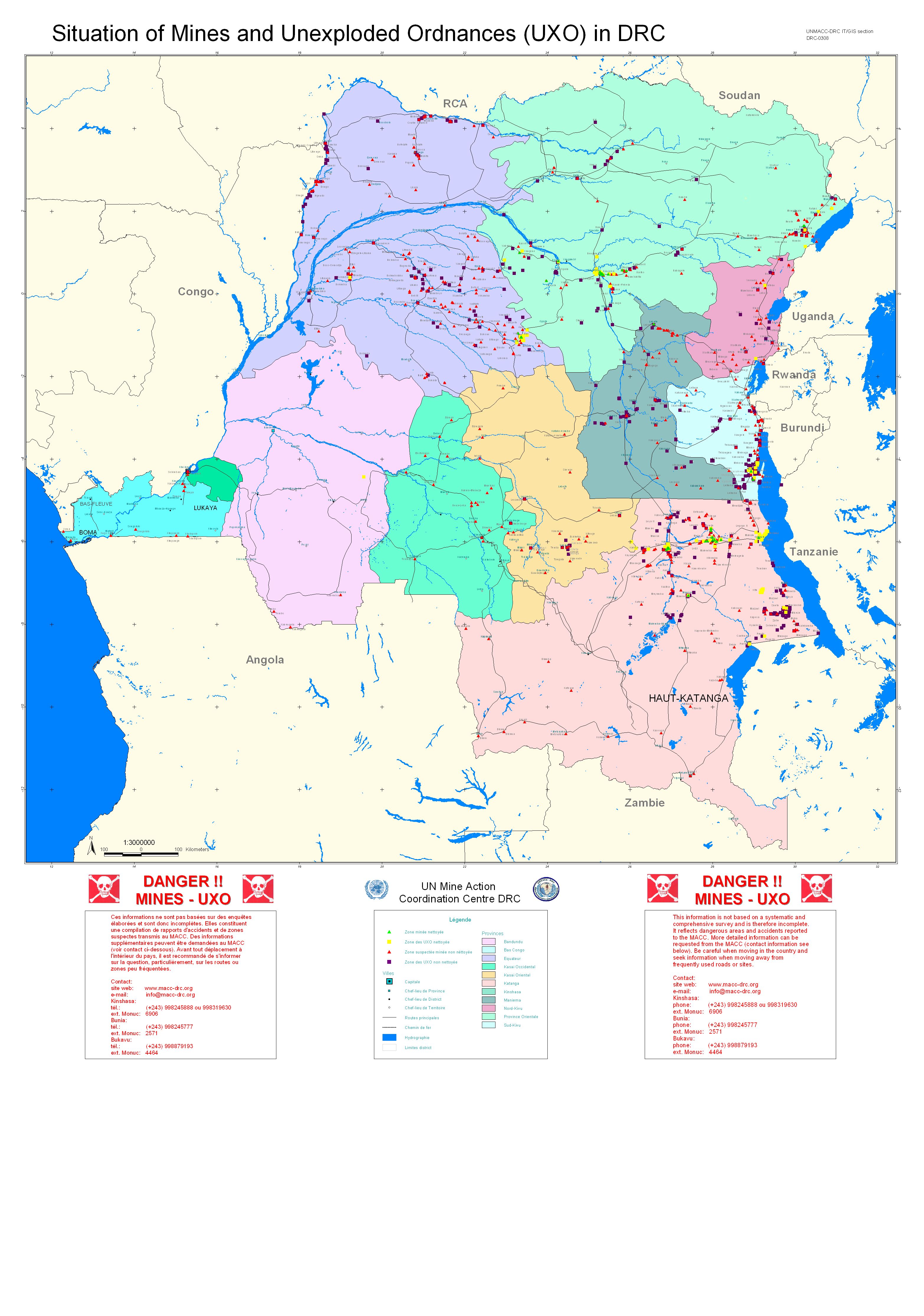
| Congo, DR |
-Situation of Mines and Unexploded Ordnance (UXO) in DRC, UNMACC, March 2008. |
| Ecuador |
-Mine situation – Loja province, CENDESMI/AICMA, September 2006.
-Mine situation – El Oro province, CENDESMI/AICMA, March 2005.
-Mine situation – Pastaza province, CENDESMI/AICMA, September 2006.
-Mine situation – Zamora Chinchipe province, CENDESMI/AICMA, March 2008.
|
| Eritrea |
-Impacted Communities, ESCA, 2004.
-Mine Impacted Communities, SAC, 2004.
|
| Iraq |
-Iraq contamination map, Iraqi Humanitarian Mine Action Agency, May 2008. |
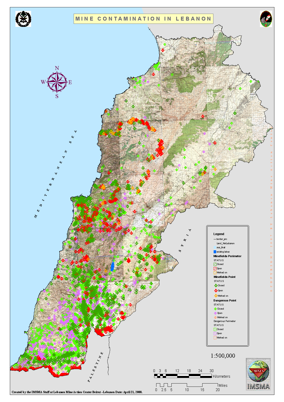
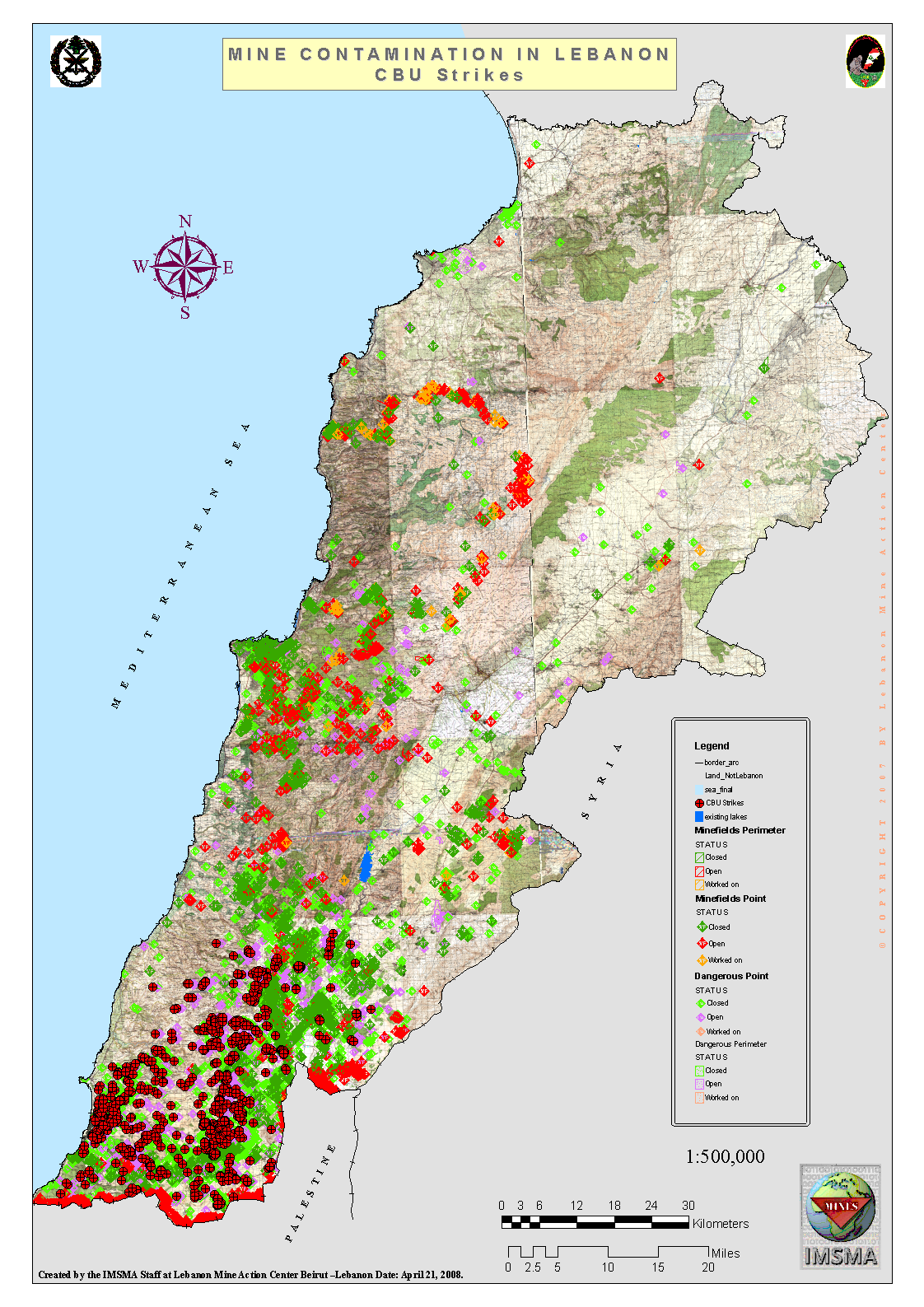
| Lebanon |
-Mine contamination in Lebanon, LMAC, 12 April 2008.
-Mine contamination in Lebanon: CBU Strikes, LMAC, 12 April 2008.
|
| Mauritania |
-Mauritania Landmine Impact Survey 2006, SAC, 2006. |
| Mozambique |
-Mozambique Minefield Status December 2007, HALO, December 2007. |
| Myanmar |
-Antipersonnel Mine Contamination Map, July 2009. |
| Nicaragua |
-Mined Areas, OAS PADCA, March 2008. |
| Peru |
-Location of dangerous areas along the northern border with Ecuador, Digedehume, May 2007.
-Identification of mined areas in the high-tension electricity towers, CONTRAMINAS, 28 March 2008.
-Identification of mined areas in national infrastructure, DIVSECOM, May 2007. |
| Somalia |
-Somalia: Phase 3: Sanaag and Sool Regions and Buuhoodle District in Toghdeer Region, SAC, June 2007.
-Somalia: Phase 2 and 3: Bari, Nugaal, Northern Mudug, Sanaag, Sool and Todgheer/Buuhoodle regions, Survey Action Center, June 2007.
-Somalia: Phase 2: Bari and Nugaal Regions and Northern Mudug Region, SAC, July 2005. |
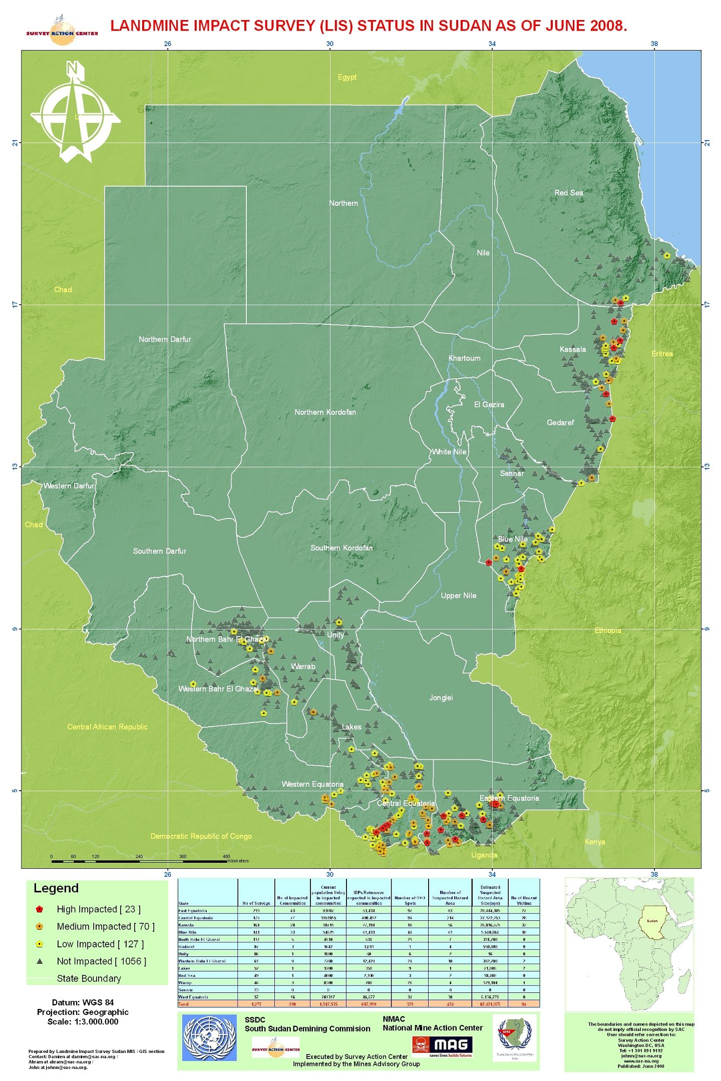
| Sudan |
-LIS Status in Sudan as of June 2008, SAC, June 2008.
-General Threat Map, UNMAO, April 2008. |
| Venezuela |
-San Fernando de Atabapo (PNSFA), Government of Venezuela, March 2008.
-Guafitas (PNGUA), Government of Venezuela, March 2008.
-Cararabo (PNME), Government of Venezuela, March 2008.
-Puerto Páez (PNPP), Government of Venezuela, March 2008.
-Río Arauca International (PNRAI), Government of Venezuela, March 2008. |
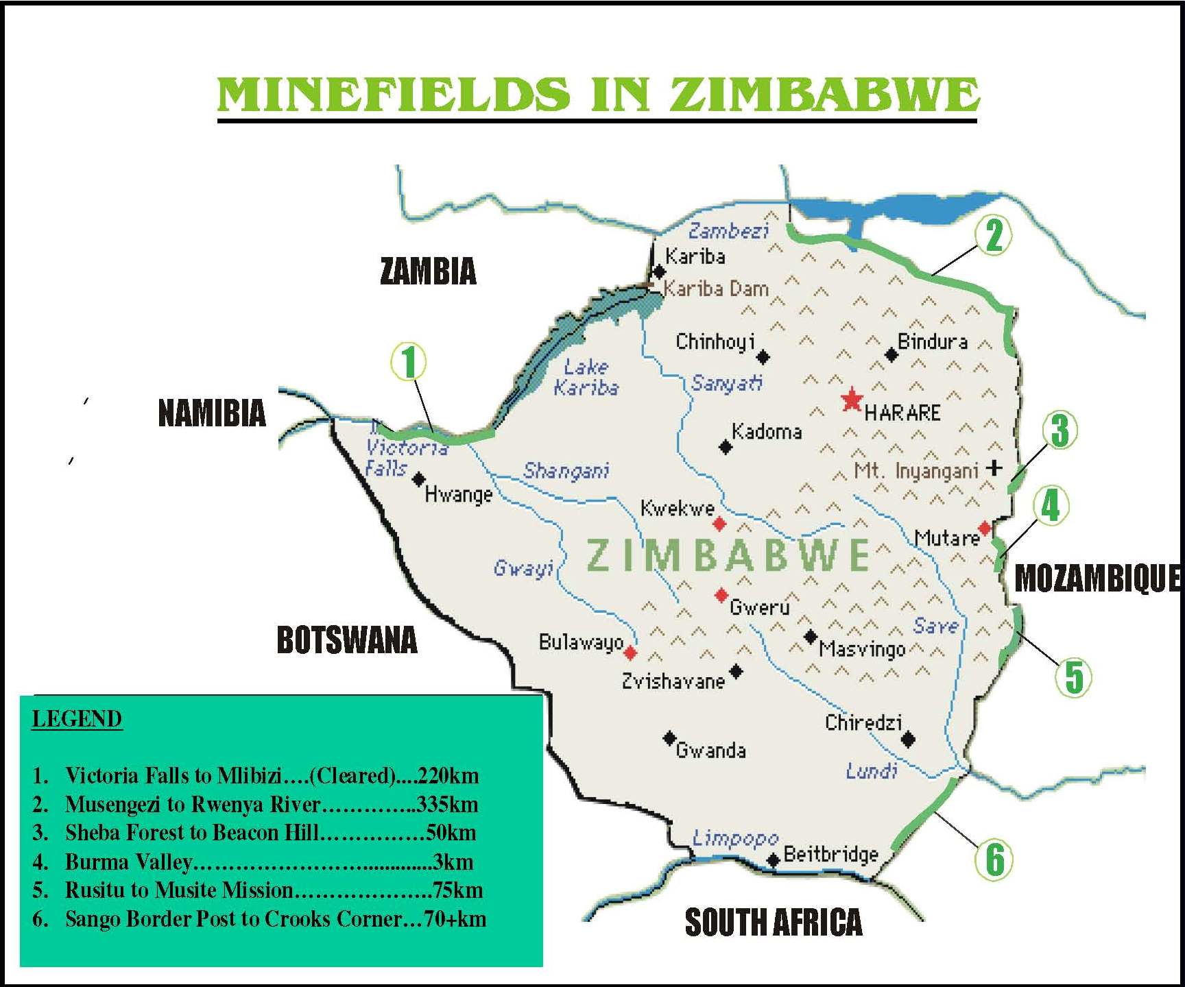
| Zimbabwe |
-Minefields in Zimbabwe, Government of Zimbabwe, November 2007. |
Tables
